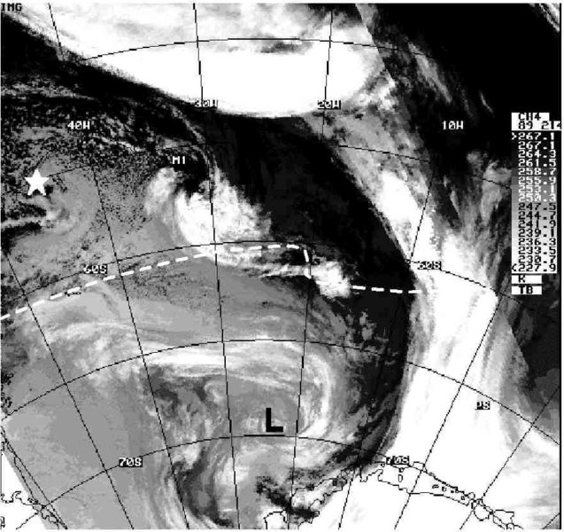
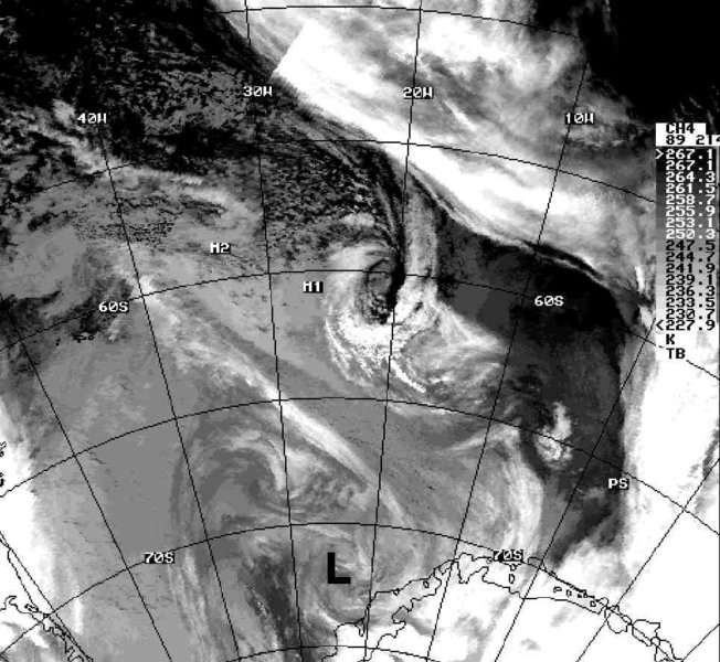
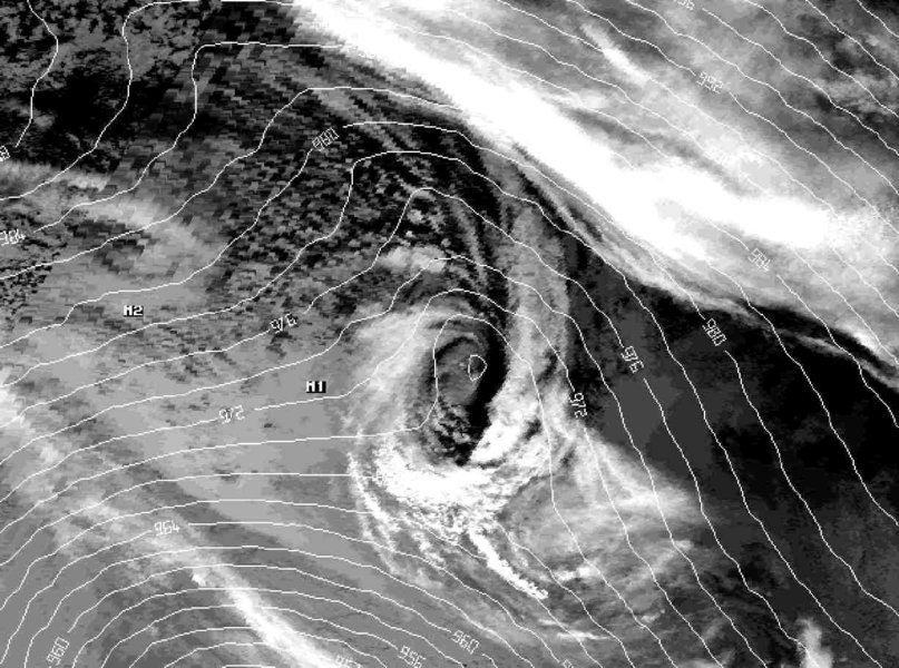
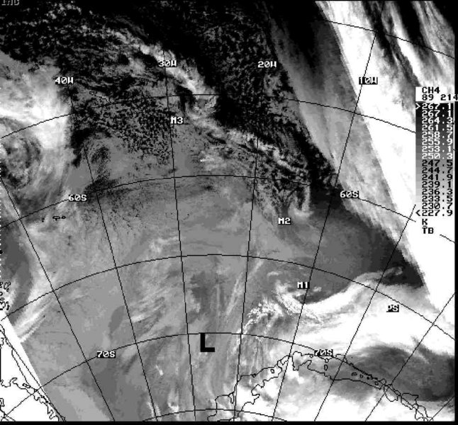
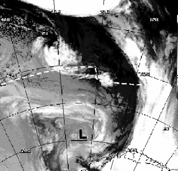
Polar low development at the sea ice edge of the northern Weddell Sea 31 July-1 August 1986
A wintertime MC developed during 30 July 1986 near the sea ice front of the northern Weddell Sea. During its initial and development phases it moved eastwards parallel to the sea ice front. During the first 24 h, baroclinic instability and diabatic heating were found to be of great importance for the intensification. During its mature stage (the following 24 h), a pronounced frontal system formed and baroclinic instability can be regarded as the main process for its further development. The MC moved over the sea ice during its mature stage, so the forcing by surface energy fluxes was less important. A cyclonic upper-level PV anomaly was found to be present during the mature stage. The MC had a diameter of about 700 km, a lifetime of more than 48 hours and reached the intensity of a polar low (measured near-surface wind speeds of up to 26 m/s). The model results revealed good agreement with observations (radiosondes and synoptic observations) in the case of the "full physics" run, but in the case of the "no cloud physics" run this was very poor. In contrast to the main MC M1, which originated from a patchy higher level cloud structure, two additional MCs M2 and M3 seemed to result from a boundary layer front (BLF) development, which formed under conditions of large-scale flow almost parallel to the sea ice edge and was advected over the open water.
References:
Heinemann, G., 1996: On the development of wintertime meso-scale cyclones near the sea ice front in the Arctic and Antarctic. Global Atmosphere-Ocean System 4, 89-123.
Heinemann, G., 1998: A meso-scale model-based study of the dynamics of a wintertime polar low in the Weddell Sea region of the Antarctic during WWSP86. J. of Geophys. Res., 103, 5983-6000.
Please click on the images for full resolution or animation.
Copyright by Günther Heinemann.