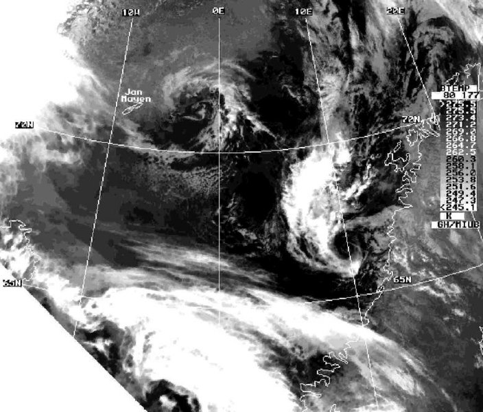
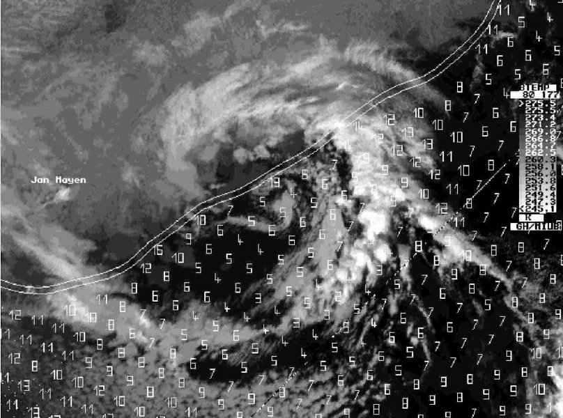
Polar low at the sea ice edge over the Norwegian Sea near Jan Mayen March 18, 1989
The MC development started already on 17 March southwest of Jan Mayen, then it moved north-eastwards along the sea ice front and became almost stationary during the afternoon of 18 March. This MC was investigated in an aircraft-based polar low study published by Douglas et al. (1995). The research flight in this MC took place in the afternoon of 18 March. Heinemann (1996) presents analyses obtained by retrievals from TOVS and SSM/I data. The MC east of Jan Mayen (having a scale of about 400 km) represents a development at the low-level baroclinic zone near the sea ice front with winds around gale force. Without the availability of the aircraft measurements or SSM/I derived wind speed, this MC would have been regarded as a rather insignificant vortex.
References:
Heinemann, G., 1996: On the development of wintertime meso-scale cyclones near the sea ice front in the Arctic and Antarctic. Global Atmosphere-Ocean System 4, 89-123.
Douglas, M.W., Shapiro, M.A., Fedor, L.S., Saukkonen, L., 1995: Research aircraft observations of a polar low at the East-Greenland ice-edge. Mon. Wea. Rev. 123, 5-15.
Please click on the images for full resolution or animation.
Copyright by Günther Heinemann.