DeMon

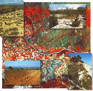
Satellite-based Desertification Monitoring In The Mediterranean Basin
Land degradation processes e.g., soil degradation and accelerated erosion, reduction of the quantity and diversity of natural vegetation are widely spread in the Mediterranean basin. Soil erosion in particular tends to develop in areas where the vegetation cover has already been seriously damaged.
The main environmentol impact results from interaction between climatic characteristics and ecologically unbalanced human interventions which are often summarized as 'desertification processes'. It is obvious that inadequate land use practises largely contribute to the acceleration of these degradation processes. In particular the southern and eastern parts of the Mediterranean basin suffer from overgrazing and excessive fuelwood collection, while other regions are more heavily affected by the excessive use of water resources through modern agriculture, tourism and urban growth.
Mapping Requirements
Mapping and repeated monitoring of the spatial extension of degradational processes form the basis for drahing and implementing rational development plans for a sustained use of Mediterranean land resources. However, although ecosystem processes with their implications for the future progress of desertification are intensely studied at numerous field sites in the Mediterranean region it is not yet clear how findings from field studies at patchscale can be extrapolated and scaled-up to relatively large areas. Detailed documentation of actual vegetation and soil conditions on regional scale is not yet available, and conventional mapping approaches (i.e. field surveys, air photo interpretation), although important and not replacable for local studies, can not provide these detailed mapping results for larger areas. This is mainly due to prohibitive costs, deficient mapping quality in difficult or inaccessible terrain and insufficient standardization and repeatability of the surveys.
Remote sensing from space platforms offers alternative information sources, but the collected radiation data do not yet correspond to the information we need and must first be interpreted in terms of the desired information.
Remote Sensing Approaches
Considering vegetation as a functional equivalent of terrestrial ecosystems, it follows that changes in vegetation structure and structural dynamics provide important indications for land degradation (desertification) processes in space and time. Their precise characterisation, together with the identification of soil conditions (i.e. detection of erosion features) constitute core elements for monitoring the dynamic behaviour of Mediterranean ecosystems. However, in view of their operational applicability, the most important requirements for satellite-based mapping relate to the standardization and portability of the used methods. This is because we not only want to map land surface conditions only once and at few locations, but wish to repeat this investigation many times for different regions with varying land surface conditions.
In the first project phase semi-empirical and physically-based approaches have been developed and tested, which seem able to achieve some of these requirements. One of these methods describes spectral reflectance signatures as a linear mixture of few prototype spectra (which we call endmembers), and has become known as "Spectral Mixture Analysis"; a complementary approach has been developed from thermal infrared measurements.


Soil Degradation
The development of soils and their degradation cause alterations of the soil surface that, to a certain extent, are spectrally detectable. In fact, eroded soils can ohen be recognised through typical colour changes which are due to the removed topsoil. If we define soil condition as a function of the mixing ratio between developed soil substrate and parent material which are spectrally distinct, the spectral characterisation of these mixtures can be used to provide precise maps of soil condition from remote sensing measurements. These principles seem to provide a widely applicable, general framework for relating spectrally detectable surface phenomena to soil conditions, thereby satisfying an important requirement for the operational application of remote sensing techniques.
Spectral Mixture Analysis (SMA)
The objective is to isolate the spectral contributions of important surface materials in so-called abundance images which permit an efficient separation of vegetation and soil related spectral information. Spectral endmembers can sometimes be retrieved from the image itself, but in the philosophy of standardisation they are better chosen from spectral libraries which provide measured spectra from groups of surface materials (e.g. different vegetation components, soils, surface rocks etc.). This type of libraries is not yet available, and needs to be constructed and completed through radiometric field and laboratory measurements. The library approach requires radiometric corrections of the satellite images prior to the thematic analysis of the data sets but, once these corrections are applied, holds the potential to be largely standardised in terms of the required processing parameters and to be used in operational scenarios.
Vegetation Abundance Estimates
Although sparse vegetation communities in semi-arid ecosystems make only a small contribution to the global carbon pool, they are perhaps the most sensitive to changes in climate. This in turn means that monitoring the dynamics of sparse vegetation communities as a regional indicator of climatic and/or anthropogenic change is an important element which remote sensing can contribute to desertification research.
Vegetation cover percentage or Leaf Area Index are structural properties of vegetation canopies that may be estimated from spectral indices ("vegetation indices") computed from reflectances measured in the visible and near infrared parts of the spectral response.
Commonly used approaches are based on spatially extrapolated empirical relationships between georeferenced ground measurements and satellite- derived simple 2-bands vegetation indices.
Several indices have been proposed in order to reduce or remove soil background influences on estimation of vegetation abundances in the case of semi-vegetated landscapes.
Given the increased robustness against soil colour differences in the absence of dense vegetation, and its ability to compensate for parts of scene illumination and shade effects, it is believed that the mixture analysis also provides better estimates of vegetation abundance than purely empirical approaches (e.g., conventional vegetation indices).
Assessing Land Degradation from Thermal Infrared Indicators
The role of temperature and emissivity for assessing land degradation (desertification) processes still needs to be more precisely investigated. Two thermal indices have been suggested: the temperature distribution and the relationship between temperature and a vegetation index. However, it seems important that the satellite-derived thermal information is interpreted on the background of conventional climatic records, and that the resulting images are used in conjuction with soil and vegetation related indicators as described above.
Thermal Infrared Remote Sensing
Some satellite sensors (Landsat Thematic Mapper, NOAA AVHRR) provide radiance data in the thermal infrared part of the electromagnetic spectrum. After atmospheric corrections (using radiosonde measurements or a splitwindow algorithm) and emissivity corrections, surface temperatures may be deduced from satellite data with a good accuracy (1 K in the land surface temperature obtained from AVHRR data). During the DeMon project, field measurements methods have been used to obtain atmaspheric radiance, and temperature and emissivity of various soil and vegetation types. Emissivity maps can then be produced by combining ground measurements and estimates of the relative proportions of bare soil and green vegetation within each pixel, obtained from satellite data.
Soil Erosion Modelling
While satellite-derived indicators enable us to monitor land degradation dynamics, any projections of future degradation risks require the use of models.
The DeMon project has so far concentrated on integrating remotely sensed data and soil erosion models, either to infer model parameters from the satellite images or to complement image-derived degradation indicators with the outputs of distributed models.
Soil erosion is a spatially and temporally highly variable process; hence a Geographical Information System (GIS) is used to store all relevant variables as separate sata layers. Since the modelling of soil erosion must take into account the spatial relationship between the various processes involved the GIS environment is also used for modelling.


Erosion Modelling for Extended Areas
Maps which are used include rainfall, soil conditions, direction of flow of water over the landsurface and vegetation cover.
Special attention is paid to the preparation of continuous maps of rainfall and of vegetation cover (using remote sensing images). The model compares the transport capacity of the overland flow with the detachment rate of the soil, and assignates actual soil loss to the lowest of these two.
For the Ardeche province, soil erosion has been modelled on a scale 1: 100.000; results indicate that soil erosion is limited by the availability of soil particles, and also that concentrated overland flow, resulting from heavy thunderstorms is likely to cause flooding in the lower parts of the catchments.
Modelling over small catchments
In order to predict runoff from small catchments (scale 1:5.000), the following data are used: a model describing the infiltration into sealed soils as a function of cumulative kinetic energy, a digital elevation model (DEM) from which local drain direction, drainage pattern and slope are calculated, rainfall data for a particular storm (intensity and cumulative kinetic energy).
Modelling of surface runoff with DEM derived parameters give a spatial pattern of runoff for soils susceptible to surface sealing. Routing of the waterflows over the DEM yeld a better insight in the spatial and temporal patterns of energy available for the detachment and transport of soil particles.
Desertification Monitoring
Desertification monitoring requires the possibility to repeatedly map vegetation and soil conditions in environmentally sensitive areas. A first change detection experiment, based on the approaches discussed above, used Landsat TM images of the north-eastern Peloponnesos (Greece) to compare the land surface characteristics between the years 1985 (19 May) and 1990 (17 May).
In large parts of our study region the photosynthetic vegetation was in fact considerably reduced. Beside "normal" variations which are mostly related to agricultural land, the affected areas appear mostly associated with locations have obviously been subject to land degradation processes already in 1985. These findings are confirmed by the fact that also the soils within these areas are dominated by degraded to severely degraded types. As a first attempt to develop concepts which are closeley related to ecological approaches we have defined a simplified formalism for combining the soil- and vegetation-related information layers which are obtained from satellite imagery. This interpretation scheme is based upon the fact that, in a more synoptic perspective, the "environmental ranking" of specific soil conditions in Mediterranean environments should be modified according to the presence of green vegetation (mainly because of its protective rolel), taking into account for example regrowth of vegetation on eroded soils or, vice versa, sparse vegetation cover on well-preserved soil resources This approach allows to interpretate each image as the result of a combined analysis of soil and vegetation conditions (here tent atively termed "sustainability index" in the sense of the varying susceptibility to degradation processes that are of importance in desertification scenarios).
It should be noted that the proposed interpretation scheme with its presently 9 categories is a first attempt to combine image-derived information about soil and vegetation conditions through a strictly formalised procedure. We are aware of the fact that this system needs to be refined and further developed in close cooperation with ecologists and specialists from various geosciences.


Present Status Of The Work - Perspectives For Future Research
New remote sensing approaches have provided results at a level of precision and spatial detail which, due to methodological and financial constraints, are difficult to obtain on a regional scale through conventional surveys. The possibility to precisely integrate the satellitebased maps with topographic data bases up to scale 1 :50,000 means that we can produce detailed inventories of existing soil degradation processes and erosion damage which may complement available large-scale surveys of soil erosion risks. The high degree of standardisation qualifies them for repeated monitoring and change detection, i.e. for obtaining information on the regional dynamics of desertification processes, such as the elimination of plant cover, accelerated water erosion, and possibly also salinization and sodification. It is this type of spatial- temporal information which we need also to optimize research about various aspects of biophysical functioning of areas affected by desertification, and which, as part of a nested hierarchy of aerial units with similar response to desertification processes (Desertification Response Units), might provide the required link between results from field studies at patch-scale and relatively large areas.
Future developments require extensions in scale and further operationalisation of the method with respect to additional terrain variability in other parts of the Mediterranean Basin. This will involve also the use of Geographic Information Systems (GIS) for providing the necessary information about variable parent rock types etc. Major emphasis, however, must be given to the analysis and interpretation of long-term time series of earth observation satellite images which cover already a period of 20 years (starting from 1972). The integrated use of these satellite derived information layers describing the dynamics of vege tation and soil conditions, the available elimatic records, and results from detailed field studies might provide a key element to understand desertification processes in the Mediterranean Basin.
