Cedric Nana (2015)
Die Implementierung eines Web-Interface zur Erkundung und Analyse von Landsat-Archiven
Satellites serve for Earth observation. They incessantly take images of the Earth’s surface and
store them in databases. The images that have been recorded over the years can afterwards be
analyzed by computerized methods. The basic idea of this analysis is mainly the mapping of
natural resources and the detection of changes that are caused by natural processes and human
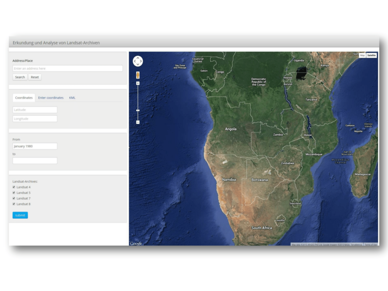
activities. The aim of this thesis is to implement a Web application, which extracts spatial
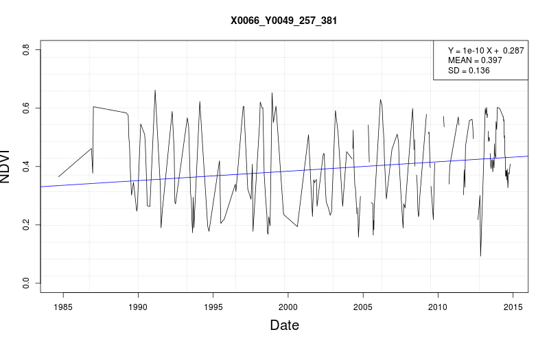
subset from time series data and provides a graphical visualization of parameters of the
normalized differenced vegetation index (NDVI). It consists particularly of building an
Interface and a data access structure for a very large database of remote sensing time series
that are stored in a tile structure, where each tile contains a several number of records.
First, a graphical user interface was implemented using web programming languages and the
Google Maps API. So a user selects an area of interest and makes a request to extract the time
series from the database. As the data are stored on a data server another mechanism was then
created for accessing them and providing an answer to the user request. Powerful server side
programming languages such like PHP and R were used for that task.