
Dr. Karlis KUKEMILKS, Wissenschaftlicher Mitarbeiter
DBU Projekt „Verwertung tonhaltiger Schlämme aus der Kieswäsche und silikatreicher Stäube als alkalisch aktivierte Bindemittel zur Herstellung neuartiger Geopolymere für ökologisch optimierte Zementrezepturen“
Die Universität Trier ist Teil eines innovativen Forschungsprojekts, das von der Deutschen Bundesstiftung Umwelt (DBU) gefördert wird. Unter der Leitung von Dr. Karlis Kukemilks, wird an nachhaltigen Alternativen zur konventionellen Zementherstellung geforscht. Ziel ist es, die CO₂-Emissionen in der Bauindustrie deutlich zu senken und dabei ungenutzte Ressourcen der Region sinnvoll zu verwerten.
Das Projekt: Nachhaltige Baumaterialien durch alternative Bindemittel
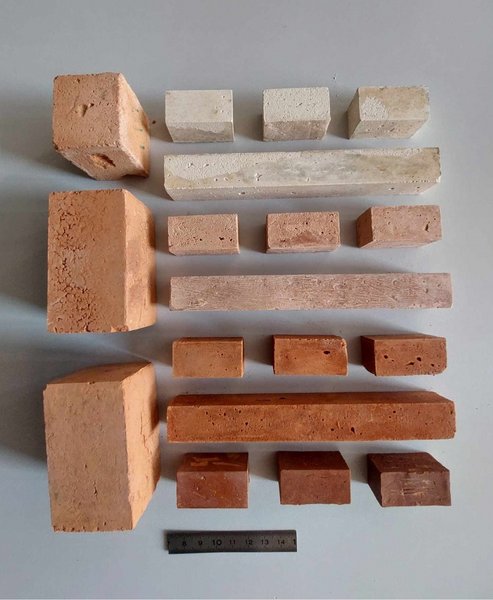
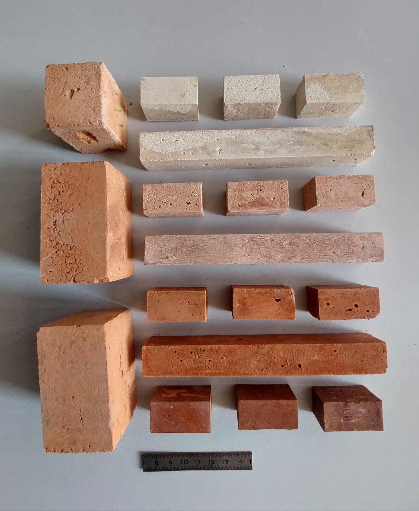
Die Zementherstellung zählt zu den größten Verursachern globaler CO₂-Emissionen – rund acht Prozent stammen allein aus diesem Sektor. Das Projektteam um Dr. Kukemilks untersucht, wie tonhaltige Schlämme aus der Kieswäsche und silikatreiche Stäube, Nebenprodukte der regionalen Industrie, in neuartigen Zementrezepturen verwendet werden können. Diese Materialien bieten ein enormes Potenzial, die herkömmliche Herstellung von Portlandzement zu ersetzen und dadurch den CO₂-Ausstoß erheblich zu reduzieren.
Der Ablauf: Von der Forschung bis zur Anwendung
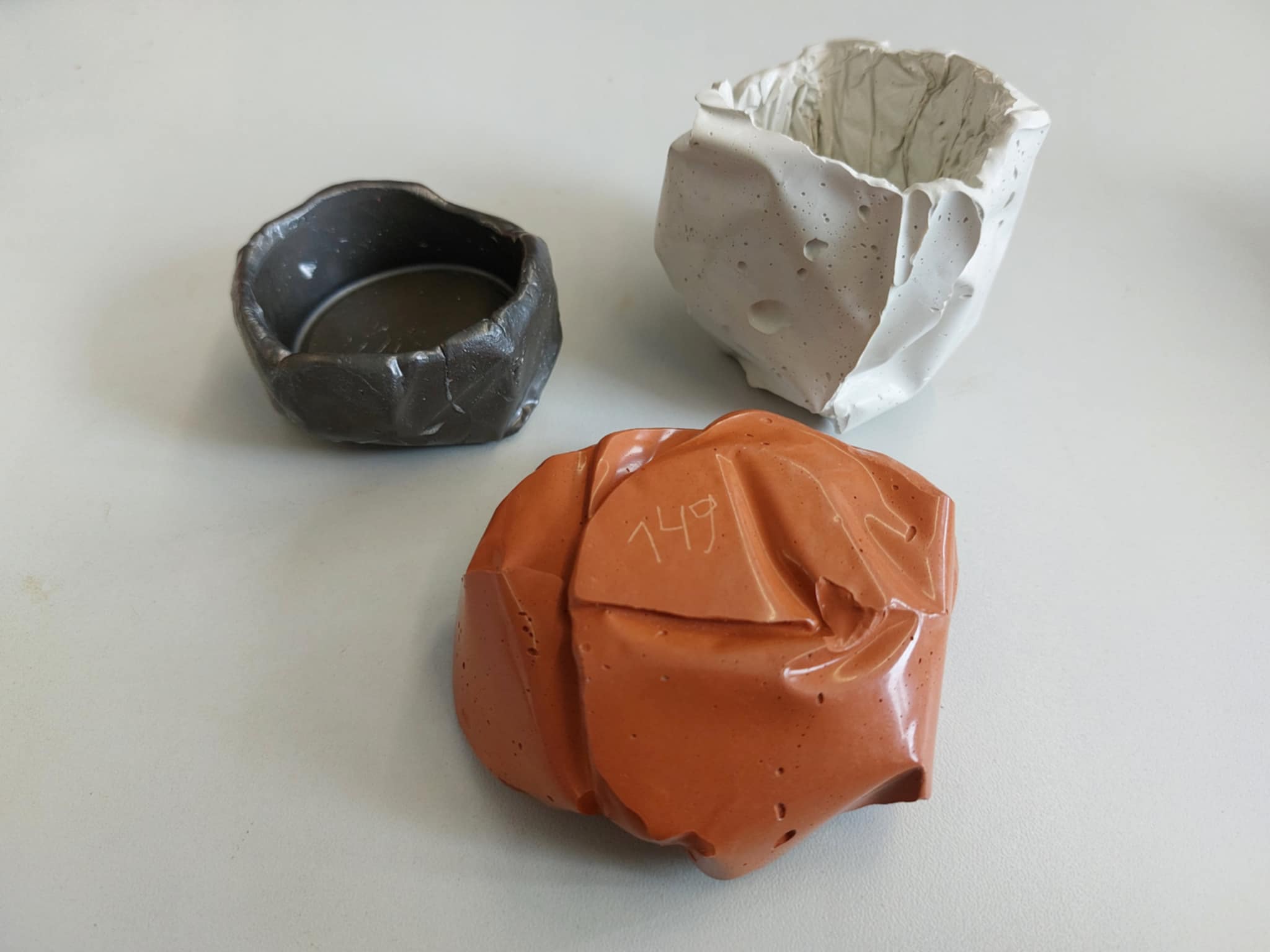
Seit dem Projektstart im Mai 2024 widmet sich das Team der Entwicklung von Geopolymerzement, einer nachhaltigen Alternative zu Portlandzement. Diese Bindemittel basieren auf gebrannten Tonmaterialien, die durch alkalische Aktivatoren wie Laugen oder Wasserglas neue Zementphasen entstehen. Geopolymerzemente zeichnen sich durch Vorteile wie hohe Säure- und Hitzebeständigkeit, herausragenden ästhetischen Eigenschaften, wie beispielsweise unterschiedlichen Farbnuancen und glänzenden Oberflächen und eine umweltfreundliche Herstellung aus – ohne die hohen Temperaturen und CO₂-Emissionen der herkömmlichen Zementproduktion.
Das Projekt läuft bis Mai 2026 und wird von mehreren Industriepartnern unterstützt. Erste Ergebnisse deuten darauf hin, dass die entwickelten Alternativzemente vielseitig einsetzbar sind, beispielsweise im Bauwesen, in der Innenarchitektur und sogar als Ersatz für bestimmte Metalle und Keramiken.
Ein starkes Netzwerk für die Region
Dr. Kukemilks betont die Bedeutung der Zusammenarbeit zwischen Wissenschaft und Industrie. Besonders kleine und mittelständische Unternehmen sind eingeladen, sich an den Forschungen zu beteiligen und von den Erkenntnissen zu profitieren. Dies stärkt nicht nur die Innovationskraft der Region, sondern leistet auch einen wichtigen Beitrag zur ökologischen Transformation der Bauindustrie.
Mit diesem Projekt setzt die Universität Trier ein starkes Zeichen für nachhaltige Entwicklung und beweist, dass Wissenschaft und Praxis gemeinsam zu einer klimafreundlicheren Zukunft beitragen können.
Für weitere Informationen können Interessierte Dr. Karlis Kukemilks direkt kontaktieren:
Forschung:
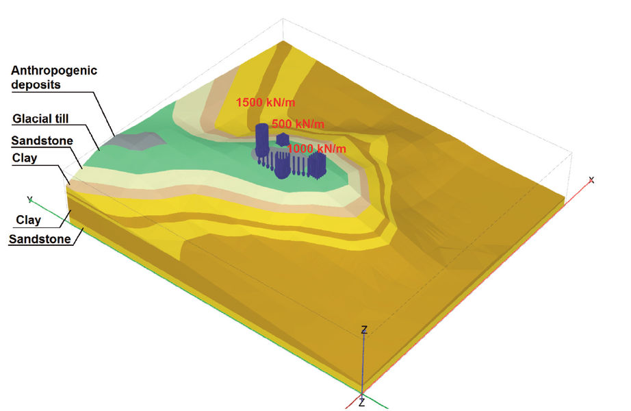
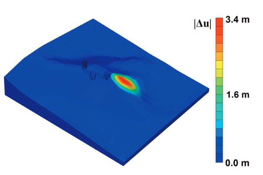
●Geomechanische Modellierung: Hangstabilität, Baugrubenverbau
●Herstellung der Ökozemente aus industriellen Abfallstoffen
●Hydrogeologische Modellierung, Entwässerung der Baugruben
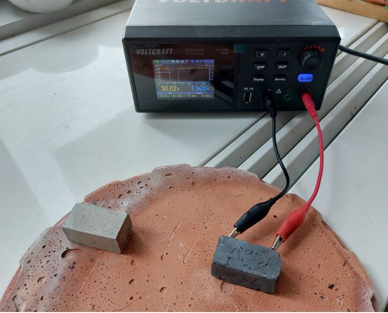
●Hydrogeophysikalische Untersuchungen: Widerstandstomographie und Eigenpotentialgeophysik
Kenntnisse der Modellierungsprogramme:
● GIS: ArcMap, QGIS
● Geomechanik: GeoStudio, Rocscience, Plaxis
●Hydrogeologie: HydroGeoSphere, PEST, MODFLOW
Publikationen:
●Kukemilks, K., Vilnītis, M. (2021) Three-dimensional slope stability model of the Turaida castle mound. Estonian Journal of Earth Sciences, 70:185-195
●Kukemilks K., Wagner, J.-F. (2021) Detection of preferential water flow by electrical resistivity tomography and self-potential method. Applied Sciences, 11:4224-4241
●Kukemilks K., Wagner J.-F., Saks T., Brunner P. (2018) Conceptualization of preferential flow for hillslope stability assessment. Hydrogeology Journal, 26:439–450
●Kukemilks K. (2018) Landslide mapping in the Abava Spillway Valley. Estonian Journal of Earth Sciences, 67:165-175
●Kukemilks K., Wagner J.-F., Saks T., Brunner P. (2018) Physically based hydrogeological and slope stability modeling of the Turaida castle mound. Landslides, 15:2267-2278
● Kukemilks, K., Saks, T. 2013. Landslides and gully slope erosion on the banks of the Gauja River between the towns of Sigulda and Ligatne. Estonian Journal of Earth Sciences, 62: 231-243
Besucheranschrift:
Dr. Karlis KUKEMILKS
FB VI/Geologie, Campus II, Gebäude F, Raum 214
Behringstr. 21, 54296 Trier
E-Mail: kukemilks@uni-trier.de
Tel.: 0651 201 4644


3D slope stability model
3D ERT Model
