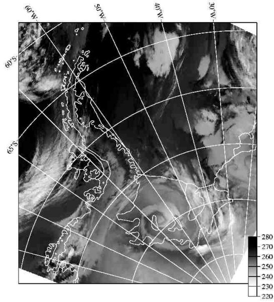
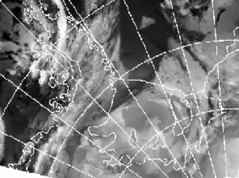
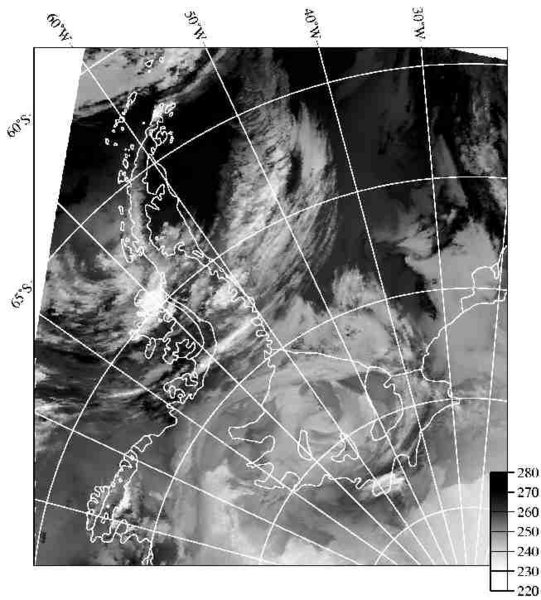
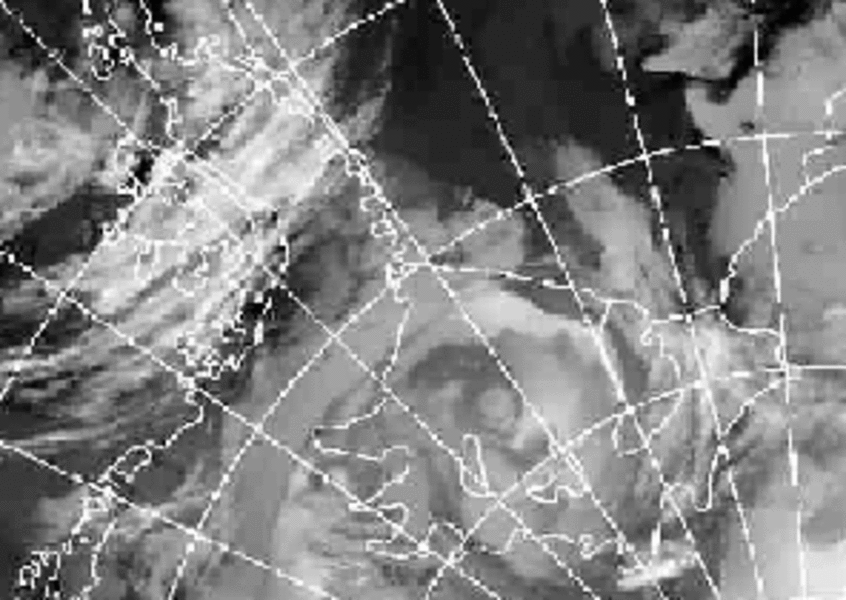
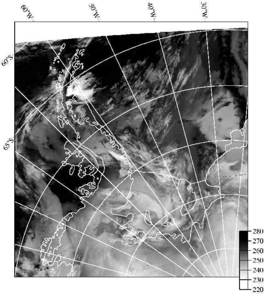
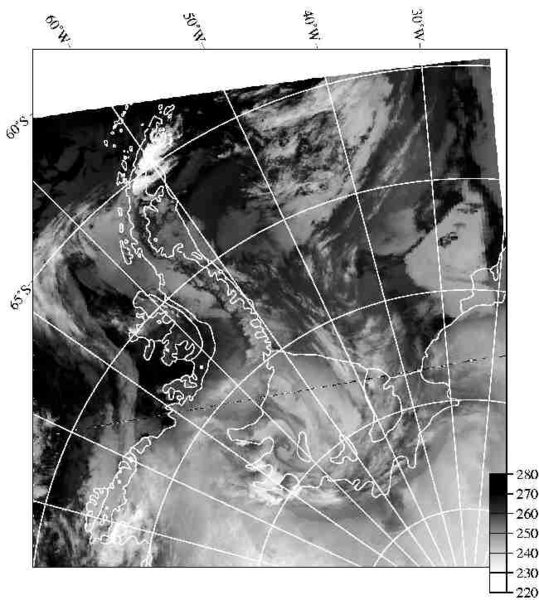
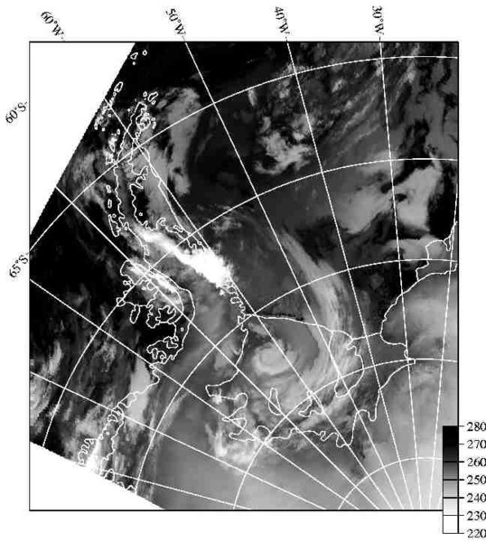
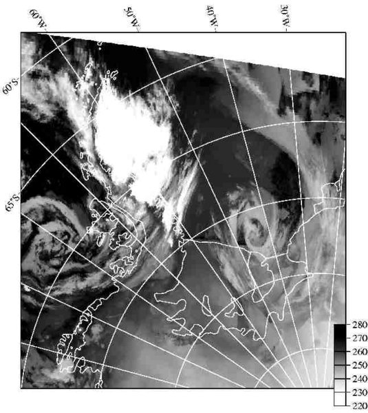
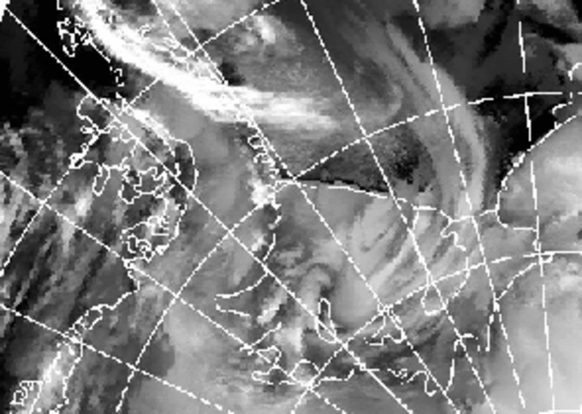
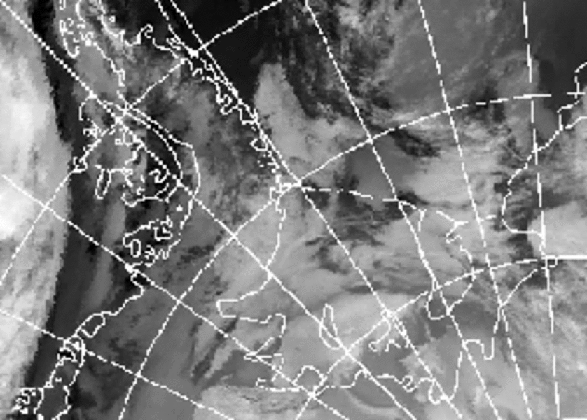
Topographically forced mesocyclone over the Filchner-Ronne Ice Shelf of Antarctica 1990
From 11 to 14 February 1990, a MC with a diameter of about 600-1000 km (sub-synoptic cyclone, SSC) was present over the Filchner-Ronne Ice Shelf (FRIS). MC developments detectable in satellite imagery are rare in that part of Antarctica (Heinemann 1990). The MC formed in the morning of 11 February southwest of Berkner Island over the FRIS and remained quasi-stationary until the evening of 12 February 1990, when it started to move westward. Within the next day, it moved northward along the southern part of the Antarctic Peninsula and reached the ice front of the FRIS northwest of Berkner Island sometime on 14 February 1990. After an intermediate reintensification over the open water, the low broadened and dissipated during 15 February 1990. Simulations of Heinemann and Klein (2001) show that upper level support is important for the MC development. The long lifetime and the movement of the MC seem to be a result of the northwards shifting of a 500 Pa cyclonic PV anomaly from about the South Pole towards the center of the FRIS.
The vortex develops as a low-level perturbation southwest of Berkner Island, which is forced by the topography structure. Shallow MCs over ice shelves at the bottom of the ice slopes seem to be a common phenomenon, but often they remain undetected in satellite imagery, since they do not show associated cloud patterns.
References:
Heinemann, G., Klein, T., 2001: Simulations of topographically forced mesocyclones in the Weddell Sea and the Ross Sea region of Antarctica. Submitted to Mon. Wea. Rev.
Please click on the images for full resolution or animation.
Copyright by Günther Heinemann.